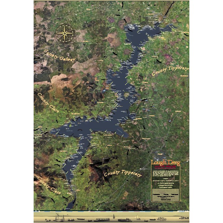
Lough Derg and its Islands map
€40.00
Lough Derg and its Islands map
format: A0 (84.1 x 118.9 cm, 33.11 x 46.81 inches)
"This is the first time where you have one map of Lough Derg showing all the access routes to the lake.”
“Every map that was ever done on Lough Derg we have examined it and every name has been included, the old with the new.”
The stunning map of Lough Derg that Gerard, Shane and a local artist Paul Berg have collaborated on shows all of the access routes to the lake for the first time in 175 years.
Reviews
There are no reviews yet.